- Ucore Rare Metals Inc.: technology and projects
- The Company is the first in the rare earth industry to demonstrate XRT as a beneficiation technique; a technology already well-established in the tungsten and diamond mining sector. XRT shows the clear potential to dramatically reduce the volume of material feeding the mill facility and an equally dramatic increase in TREO ore grade without a great deal of processing.
- Their innovations include DEXRT sorting; recycling of nitric acid leach reagents; elimination of Tailings Management Facility (TMF) at surface upon closure; and Solid Phase Extraction technology for REO purification. The use of DEXRT sorting results in all tailings being placed underground as cemented paste backfill. In all, the innovations have generated a proposed mining regime that is among the least expensive and highest rates of return in the industry.
- Source: http://rareearthinvestingnews.com/12040-ucore-announces-96-3-recovery-of-rare-earth-oxides-at-dotson-ridge.html
- Bokan Mountain, Alaska
- Ucore’s flagship property at Bokan Mountain is situated at the southern most part of the Alaskan panhandle, on the southern end of Prince of Wales Island. It is approximately 60 km southwest of Ketchikan and 130 km northwest of Prince Rupert. The Bokan Mountain project covers 30 sq. km (19 sq. miles)
- Bokan Project- top 10 advantages
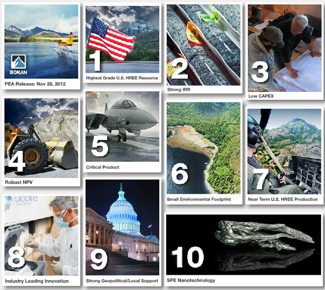
- 1. Highest Grade U.S. HREE Resource
- 2. Strong IRR
- 3. Low CAPEX
- 4. Robust NPV
- 5. Critical Product
- 6. Small Environmental Footprint
- 7. Near Term U.S. HREE Production
- 8. Industry Leading Innovation
- 9. Strong Geopolitical/Local Support
- 10. SPE Nanotechnology
- Ray Mountains, Alaska
- The Ray Mountains region of central Alaska features an extensive sheet of alluvial sediments locally 100 m (325 ft) thick. The alluvial deposits, containing widespread concentrations of REE, Sn, W, Zr ± Nb, Ta heavy minerals, are primarily derived from granitic source rock of the Ruby Batholith, and they are most abundant in the lower elevation terrain between the Ray Mountains and the northern Fort Hamlin Hills.
- Through a wholly owned operating subsidiary, Ucore holds claims on land selected for its mineral resource potential by the State of Alaska as part of the state’s land entitlement under the 1958 Alaska Statehood Act. Ucore is planning expanded exploration once title transfer is tentatively approved by the federal government.
- The Ray Mountain area is accessed by the Dalton Highway from Fairbanks and barge service is seasonally available along the Yukon River connecting directly to the Alaska Railroad freight yard at Nenana.
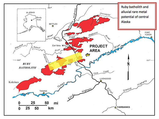
- Ruby Batholith Alluvial Samples
- Map of central Alaska showing the occurrences of the Ruby batholith (red) and the project area (yellow; UCU land holdings).
- Inset map of Alaska shows the location of the company’s property (“Project Area”).
- Greater Newfoundland
- In addition to Ucore’s substantial project at Lost Pond, the company has acquired extensive claims throughout Western Newfoundland and in Labrador.
- Sandybeach Lake, Nunavut
- During 2006 Ucore established a promising land package in Nunavut, in proximity to the Northern Manitoba border on NTS map sheets 65B/4 and 65C/1. The Sandybeach Lake Property (SLP) is centered on Sandybeach Lake located 5 km northeast of the northern extents of Neultin Lake.
- Lost Pond, Newfoundland
- Project Highlights
- • U3O8 Content – 20 sample program has produced U3O8 values ranging from 198.5 and 9700 ppm, with average U3O8 content of 0.39% (05/2006)
- • Unconformity – Documented geological unconformity.
- • Bedrock Source – Radioactive boulder field traced to a bedrock source within claim boundaries.
- • Exploration Targets – Multiple radioactive and magnetic targets identified by interpretation of preliminary airborne survey.
- • Infrastructure – Extensive pre existing network of logging roads, access routes and power supply.
- • Accessibility – Adjacent to Trans Canada Highway and related transportation routes.
- • Proximity – Near to economic centres, readily available labour forces, industrial, transportation and sustainable infrastructure.
- Overview
- Lost Pond is Ucore’s largest Newfoundland holding, located near the province’s west coast. The property is comprised of 1646 contiguous claims, spanning a territory in excess of 400 square kilometers. Lost Pond covers the southern portion of the Deer Lake Basin, an area that features a documented unconformity contact between the sedimentary rocks of the basin and the localized granites. This configuration is an established characteristic of potential uranium genesis and placement.
- Source: http://ucore.com/projects
-
About us
Contact us
Make a suggestion
- Metalpedia is a non-profit website, aiming to broaden metal knowledge and provide extensive reference database to users. It provides users reliable information and knowledge to the greatest extent. If there is any copyright violation, please notify us through our contact details to delete such infringement content promptly.